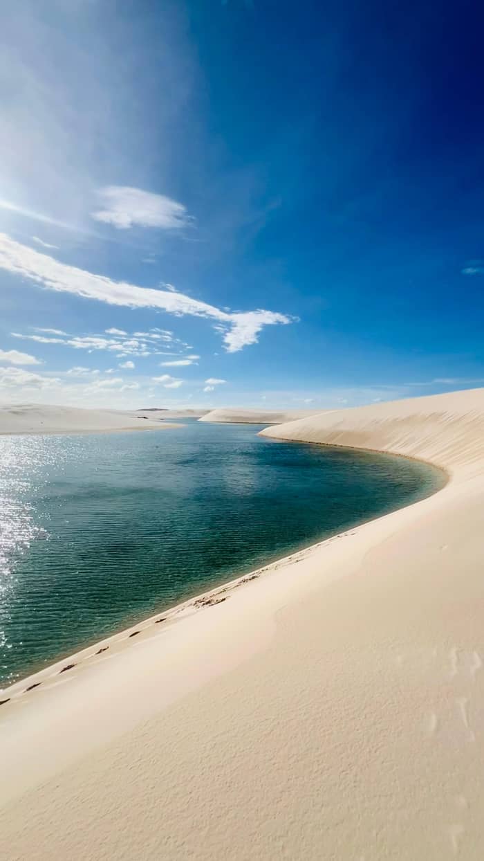
Most choice
Barreirinhas
The main base, east side
- From Sao LuisBy road, daily buses
- Classic tripsLagoa Azul, Lagoa Bonita
- BedsHotels to eco resort
Guides
Language
Currency
Find open datesfrom $90 · cancel for freeExplore the stops
The quick version
Lencois Maranhenses is a national park on the Atlantic coast of Maranhao in north-east Brazil, reached from Sao Luis by a road of about 3 hours to Barreirinhas, its main gateway.
Getting in
See 17 route stops
Start by picking a route; tap a pin or stop for its note and Google Maps.
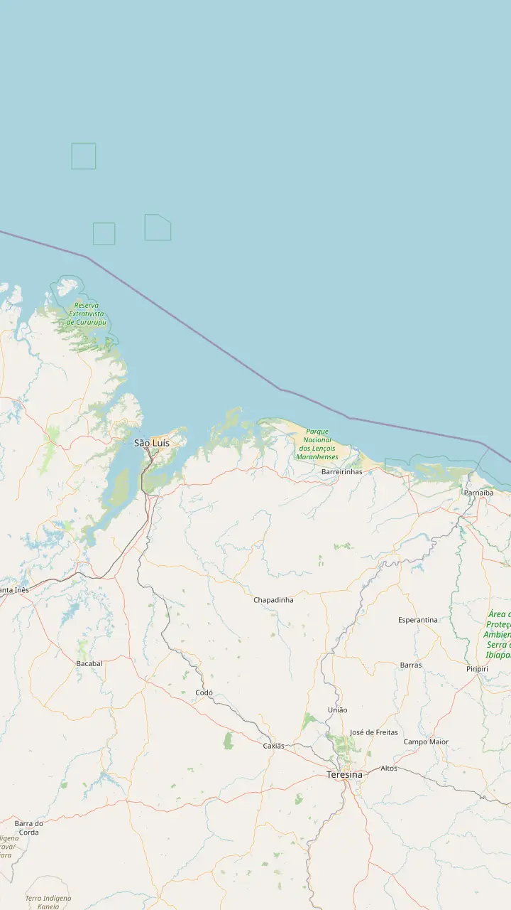
The nearest commercial airport to the park; the road on to it takes 3:30 hours on average, depending on the gateway.
Google MapsThe main base for the park, on the Preguicas river; daily buses from Sao Luis, and the Lagoa Azul and Lagoa Bonita trips start here.
Google MapsThe western gateway: paved road since 2017, with lagoons close enough to reach on foot, by 4x4 or by boat.
Google MapsA fishing village between the dunes, the beach and the river, and now a kitesurfing hub partly inside the park.
Google Maps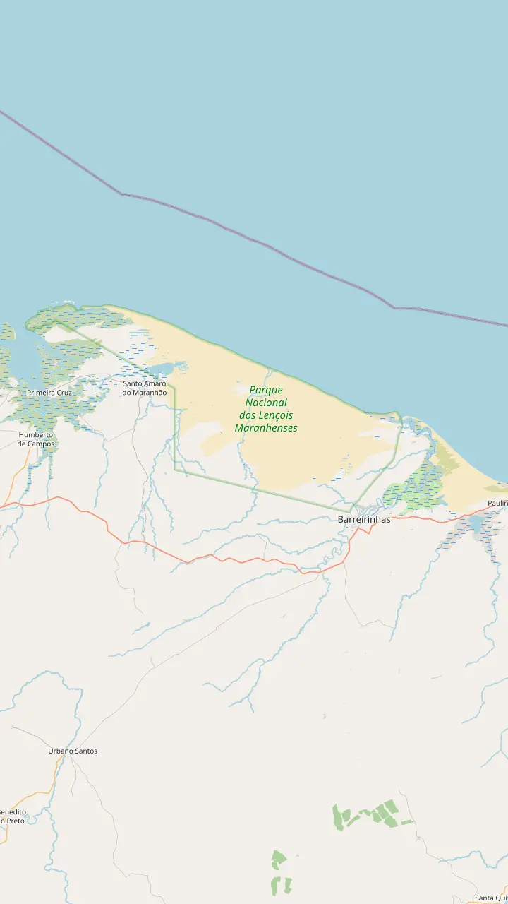
The main base for the park, on the Preguicas river; daily buses from Sao Luis, and the Lagoa Azul and Lagoa Bonita trips start here.
Google MapsThe most visited lagoon of the park, and the closest to where the 4x4 trucks stop.
Google MapsSet on one of the highest points of the park, with a panoramic view over the dune field.
Google MapsThe lagoon here can turn reddish, tinted by the buriti palm groves around it.
Google MapsThe Rio Negro forms it at the edge of the moving dunes; its water is permanent and up to 12 m deep.
Google MapsThe first night stop when the crossing starts in Atins, after a direct walk of 6 hours.
Google MapsAn oasis of green restinga in the dunes, home to fishing families and a night stop on the crossing.
Google MapsHolds a good water level through the dry months, when other lagoons on the Santo Amaro side empty.
Google MapsReached by land or along the Rio Grande, with dunes lining the riverbank.
Google MapsBig blue and green lagoons near Santo Amaro, and among the busiest stops in the park.
Google MapsThe largest lagoon in the park by the state's account, and one that never dries out.
Google MapsThe western gateway: paved road since 2017, with lagoons close enough to reach on foot, by 4x4 or by boat.
Google Maps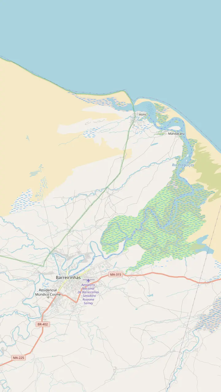
The main base for the park, on the Preguicas river; daily buses from Sao Luis, and the Lagoa Azul and Lagoa Bonita trips start here.
Google MapsThe most visited lagoon of the park, and the closest to where the 4x4 trucks stop.
Google MapsHome of the Lagoa do Mario, which restinga encircles, unlike most lagoons here; carnivorous plants grow nearby.
Google MapsA fishing village between the dunes, the beach and the river, and now a kitesurfing hub partly inside the park.
Google MapsMandacaru's 54 m lighthouse, with a view over the dunes and the river mouth from the top.
Google MapsA beach on the far side of the Preguicas river, listed by the park among the region's other attractions.
Google MapsBase map © OpenStreetMap contributors
Where is Lencois Maranhenses exactly? On the eastern coast of Maranhao, a long road from the airport. Here is the map, the gateways and every way in.
Editorial team, lencoismaranhensestour.quest · Updated November 11, 2026 · ~8 min read
Basics
Where is Lencois Maranhenses, in plain terms? It is a national park on the Atlantic coast of Maranhao, the state that forms the north-eastern shoulder of Brazil where the Amazon gives way to the dry north-east. A NASA caption places the dune field on the country's north coast, about 700 km east of the mouth of the Amazon.8 Barreirinhas, Santo Amaro do Maranhao and Primeira Cruz, 3 municipalities in all, share the park between them.1
On a road map the park is a pale wedge between Sao Luis, the state capital, and the delta of the Parnaiba river. The state tourism office describes white dunes reaching about 50 km inland from the sea and running along more than 70 km of empty beach.9 ICMBio, the federal agency that manages it, gives the park an area of 156,608.16 hectares, with 2/3 of it covered by dunes and the lagoons between them.10
That position explains the landscape. NASA's Earth Observatory notes that the dune field sits where three Brazilian biomes meet, with Amazon rainforest to the west, Cerrado savanna to the south and the thorny Caatinga to the east.11 You feel the mix on the drive in, as palm groves, mangroves and scrub take turns outside the window, and the sand appears only at the very end, often all at once.
Ways in
| Way in | Time | Price | Good to know |
|---|---|---|---|
| Drive to Barreirinhas | 3 hrs by car | Fuel and parking | Car stays in town |
| Daily bus | Daily departures | Ask at the terminal | Leaves the Sao Luis terminal |
| Shared transfer | 4.5 hrs | from $47 | Pickup at your lodging |
| Private car | 4 to 4.5 hrs | from $265 | Your own group |
| Transfer to Santo Amaro | 5 hrs | from $47 | Western gateway |
| Speedboat to Atins | 1.5 hrs | from $51 | From Barreirinhas |
Times and routes from the state tourism office and the listings; prices are from-prices on GetYourGuide and may change.3
Almost every trip starts in Sao Luis. The park's public use plan names the capital's airport as the nearest commercial one, and puts the average road journey from there at 3:30 hours, depending on which gateway you choose.2 ICMBio also lists Parnaiba, over the border in Piaui, as a second airport near the park, which can suit you if you arrive from the Jericoacoara side of the coast rather than from the capital.12
Sao Luis deserves at least an evening of its own. The historic centre is a destination in its own right, and spending a night there lets you take a morning transfer rather than racing a late flight to the coast. It also gives you a buffer if the flight is delayed, which matters when the transfer to the dunes has fixed departure windows and the drive is long. Book a room near the old centre and you can walk to dinner on the first night. Planning a Sao Luis to Lencois Maranhenses tour as separate pieces, a transfer and then a lagoon day, is simpler than it sounds.
The shared transfer on this site's booking partner shows that rhythm clearly. The minibus runs roughly between 6:45 and 8:00 in the morning and between 16:00 and 17:00 in the afternoon, takes 4.5 hours, and allows one bag of up to 10 kg per passenger, with a fee for extra luggage. Pack light for the dunes anyway: you will carry little more than water, sunscreen and a swimsuit once you are there.
Barreirinhas, on the Preguicas river, is the main base for the park, and the classic Lagoa Azul and Lagoa Bonita trips start there.13 The state tourism office lists the route from Sao Luis as the BR 135 to Bacabeira, the BR 402 to Rosario, then the MA 110, MA 226 and MA 225 into town, and reckons on 3 hours by car.3 It is the gateway easiest to reach from the capital, with the widest choice of beds.18
There are several practical ways to cover that road. Buses leave the Sao Luis bus terminal every day.3 A shared transfer collects you and drops you at your lodging, from $47. A private car for your own group runs 4 to 4.5 hours each way. Or you drive yourself, which gives the most freedom between town and coast but stops at the park boundary, as the next sections explain.
If you are planning a Lencois Maranhenses tour from Sao Luis in a single push, be realistic about the clock. With 4.5 hours on the minibus and the morning departure window, you reach Barreirinhas around midday at the earliest, and the full-day lagoon tours leave in the morning. The simple plan is to sleep in Barreirinhas and book the lagoon day for the next morning, which leaves the arrival afternoon for a walk along the river and an early night.
Which way in?
Start from your time, your energy and where you come from.
If I have little time and want the classic lagoons
Barreirinhas
Lagoa Azul and Lagoa Bonita trips start there.13
If I want to walk to the lagoons from town
Santo Amaro
Lagoons can be reached on foot from town, with a guide.14,15
If I want beach, wind and a village feel
Atins
A fishing village turned kitesurfing hub.16
If I am coming from Jericoacoara
The eastern road
The Route of Emotions reaches Barreirinhas via the MA-315.17
If I want no driving at all
Shared transfer
Pickup at your lodging, 4.5 hours to Barreirinhas.
Pick a gateway
Most choice
The main base, east side
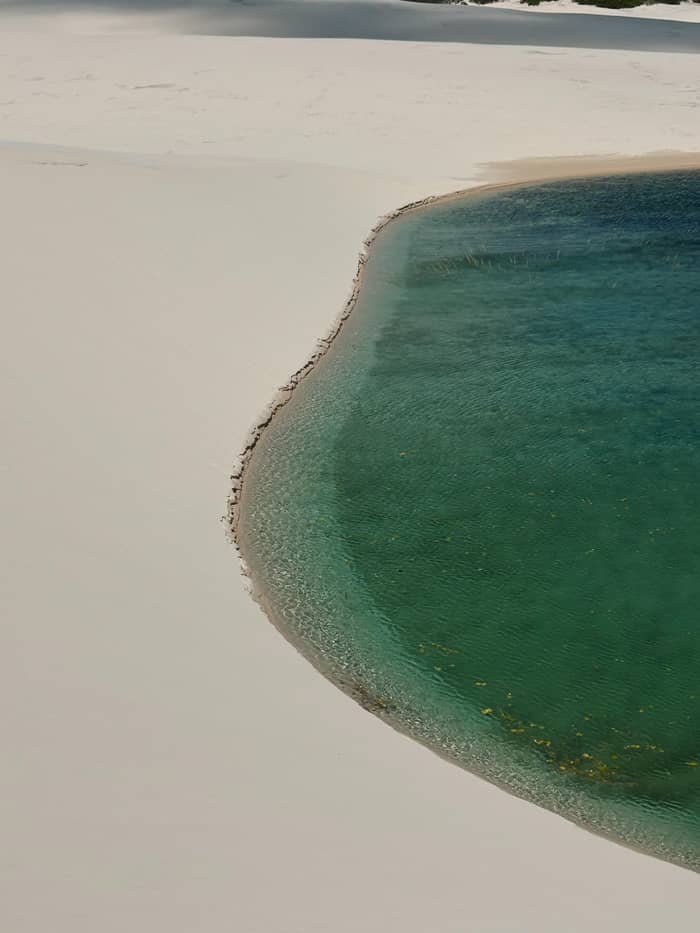
Lagoons on foot
The western gateway
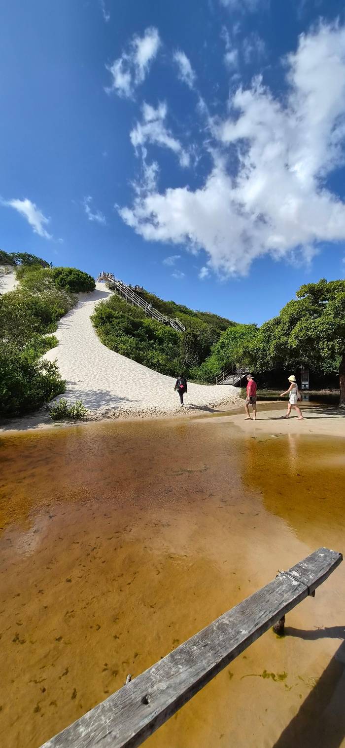
Village by the sea
At the river mouth
Santo Amaro do Maranhao is the park's second gateway, on its western side.4 The park plan records that its access road was paved in 2017, and that since then it has become the bordering town easiest to reach from Sao Luis.19 An older description on the state tourism site still describes the last 40 km in 4x4 vehicles from the village of Sangue, so treat any guide that warns of a long sand track as out of date.38
What makes Santo Amaro different is how close the sand is. ICMBio says the town lies less than 2 km from the park, reached on foot or by accredited vehicle.39 The state describes bigger lagoons and higher dunes on this side, with lagoons you can walk to from town.40,14 Walking out alone is still a mistake. With no signposting in the park, the state warns, it is easy to lose your way among the dunes, and every ridge looks like the last one.15
A transfer from Sao Luis to Santo Amaro takes about 5 hours on the listing we checked, from $47. Santo Amaro suits travellers who want quieter days and lagoons within walking reach, and it is where the long crossing on foot from Atins ends. The state calls it the gateway for adventure, while Barreirinhas is its gateway for ecotourism.41 Expect fewer restaurants and agencies than in Barreirinhas, and plan cash and supplies accordingly.
Price the journey
Pick a ride and the number of travellers.
Compare 4 choices
Pick a ride and the number of travellers.
≈
View≈
View≈
View≈
ViewFrom-prices on GetYourGuide, shown at the ECB reference rate. Your exact price is confirmed during booking.
Arrival day
Landing
The nearest commercial airport to the park.2
Early morning
Shared transfers leave between 6:45 and 8:00.
On the road
The state's route runs via Bacabeira and Rosario.3
Around midday
The transfer takes 4.5 hours door to door.
Next morning
Pickup for the full day on both circuits.
Evening
The tour ends with the sunset on the dunes.
Atins is a fishing village between the dunes of the Grandes Lencois, the beach and the Preguicas river, close to the Azul and Bonita lagoons.5 The park plan describes it as a former village of traditional fishermen that has become an important place for kitesurfing.16 It has no road from Sao Luis of its own: you reach it from Barreirinhas, by boat down the river or by off-road vehicle across the sand.
The boat is the more scenic way. The state tourism office points out that arriving along the Preguicas lets you explore the creeks and meet the people who live on them, without hurry.42 A shared speedboat transfer takes 1.5 hours, from $51. On the way the river passes Mandacaru, whose 54 m lighthouse gives a sweeping view of the dunes and the river from the top.22 The climb is steep, so save some energy for it.
Across the water lies Cabure, a beach the park plan lists among the region's attractions beyond the park, along with the Pequenos Lencois and the river itself.21 If you choose Atins as your base, you can arrange the boat and lagoon trips from the village, but check the last river crossing of the day before you commit, since there is no quick way back to Barreirinhas once it has gone.
Video
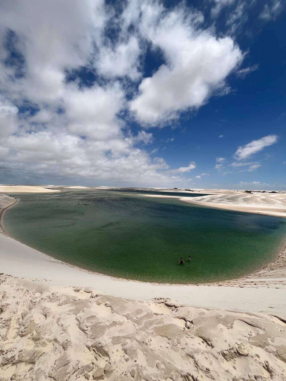
Travelling With Con on YouTube · Your tap on play is what loads the video.
The park can be reached from two towns: Barreirinhas, to the east, and Santo Amaro do Maranhao, to the west; in both, local agencies sell trips to the largest and nearest lagoons.
Getting there
Many travellers arrive from the east rather than from Sao Luis. ICMBio places the park on the Route of Emotions, which links destinations along the coasts of Ceara, Piaui and Maranhao.43 The overland approach runs from Jericoacoara through the Parnaiba Delta and on along the MA-315 eco road between Paulino Neves and Barreirinhas.17 It is the natural way in if Jericoacoara is already on your route.
The appeal of this route is the coast you see on the way: the delta's channels and mangroves, small beach towns and, near Paulino Neves, the smaller dune field of the Pequenos Lencois. The state describes the Pequenos Lencois as an environmental protection area in the buffer zone of the national park.44 Expect a full travel day, and book it with an operator who runs the route regularly.
If you fly instead, Parnaiba's airport is the one on this side of the park.12 Whichever direction you come from, aim to arrive in Barreirinhas or Atins with a free afternoon. It gives you a margin for delays on a long road, and the lagoon trips are best started fresh, since the walking over soft sand is real exercise even on the short circuits. A rested first morning makes the whole visit better, whatever the season.
Your own car gets you to the gateway towns, not into the park. ICMBio allows only vehicles, drivers and guides accredited through a public call to take visitors inside.7 Private cars, motorbikes, buggies, quad bikes and UTVs that the agency has not authorised may not enter.45 The state tourism office sums it up from the visitor's side: you go in by 4x4 with a town agency, which leaves you at the edge of the dunes.46
From that drop-off point you continue on foot. The park plan describes visitors walking over the dunes from the support point to a sequence of lagoons.47 That is why every tour here is partly a hike, and why the state advises good fitness, sunscreen, light clothes and steady drinking.35 In many places the dunes give no landmark and no shade, so going with a guide is safety, not a formality.
Phones are not much help either. ICMBio warns that it is very easy to get lost in the dune field and that much of it has no mobile coverage.36 Book the lagoon day through an accredited operator, keep your guide in sight, and treat the map on this page as a way to understand the distances rather than a route to follow alone. The park is open to visitors all year round, so the journey itself is the only thing you really need to plan around.37
FAQ
It is a national park in north-east Brazil, spread over Barreirinhas, Santo Amaro do Maranhao and Primeira Cruz.1
Buses leave the Sao Luis terminal daily; shared transfers also collect you from your lodging.3
A shared speedboat down the Preguicas takes 1.5 hours.
The Route of Emotions runs through the Parnaiba Delta and along the MA-315 to Barreirinhas.17
Sources
Up next
Which lagoon circuit, which month? Ask a real person.